
Capture Coastal Change with CoastSnap
CoastSnap is a global citizen science project to capture our changing coastlines. If you have a smartphone and an interest in the coast, we'd love you to participate.
You can now help track these changes along our coastline with the CoastSnap stations located at Grange Jetty, Henley Jetty, the Point Malcolm Beach Access Ramp and West Beach.
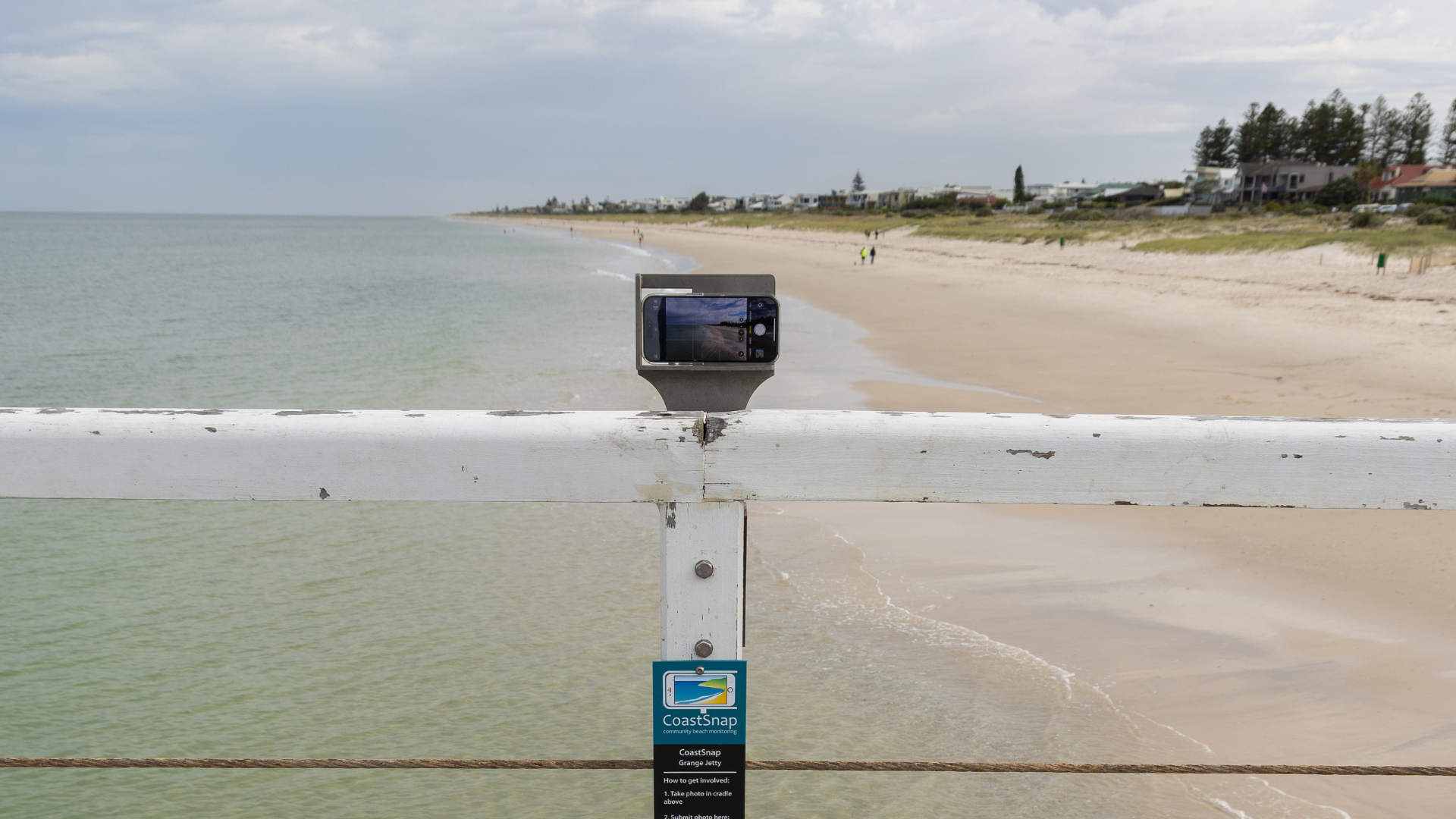
Each station features a QR Code and a cradle to place your phone to ensure every photo is captured from the same position, angle and height. Your photos will help monitor the ongoing changes to our beaches and help the community and scientists understand how our coastline is impacted by seasons, storms, sea levels, human activities and other factors.
The more photos our community take, the more data we have.
In the near future we'll be able to share timelapse videos using the images collected from your CoastSnap station to showcase qualitative beach changes over time.
CoastSnap will also provide us with shoreline mapping to show quantitative changes to the shoreline. By building up this data from images collected over a period of time, we are able to develop a series of shoreline records and this data can be used to analyse changes to the beach width, using virtual cross-shore profiles.
We look forward to sharing this information when it becomes available and enough data has been collected.
It’s easy to participate - simply scan the QR Code at a CoastSnap station, snap a picture and upload it to the CoastSnap website.
CoastSnap Locations
Recent Reports
Grange Jetty
CoastSnap Report - Grange Jetty: April 2026 to June 2026
CoastSnap Report - Grange Jetty: January 2026 to March 2026
CoastSnap Report - Grange Jetty: October 2025 to December 2025
CoastSnap Report - Grange Jetty: July 2025 to September 2025
CoastSnap Report - Grange Jetty: April 2025 to June 2025
CoastSnap Report - Grange Jetty: January 2025 to March 2025
Henley Jetty
CoastSnap Report - Henley Jetty: April 2026 to June 2026
CoastSnap Report - Henley Jetty: January 2026 to March 2026
CoastSnap Report - Henley Jetty: October 2025 to December 2025
CoastSnap Report - Henley Jetty: July 2025 to September 2025
CoastSnap Report - Henley Jetty: April 2025 to June 2025
CoastSnap Report - Henley Jetty: January 2025 to March 2025
Point Malcom Beach Access
CoastSnap Report - Point Malcom : July 2025 to December 2025
West Beach North
CoastSnap Report - West Beach North: April 2026 to June 2026
CoastSnap Report - West Beach North: January 2026 to March 2026
CoastSnap Report - West Beach North: October 2025 to December 2025
CoastSnap Report - West Beach North: July 2025 to September 2025
CoastSnap Report - West Beach North: April 2025 to June 2025
CoastSnap Report - West Beach North: January 2025 to March 2025
West Beach SLSC
CoastSnap Report - West Beach SLSC: April 2026 to June 2026
CoastSnap Report - West Beach SLSC: January 2026 to March 2026
CoastSnap Report - West Beach SLSC: October 2025 to December 2025
CoastSnap Report - West Beach SLSC: July 2025 to September 2025
CoastSnap Report - West Beach SLSC: April 2025 to June 2025
CoastSnap Report - West Beach SLSC: January 2025 to March 2025
West Beach South
CoastSnap Report - West Beach South: April 2026 to June 2026
CoastSnap Report - West Beach South: January 2026 to March 2026
CoastSnap Report - West Beach South: October 2025 to December 2025
CoastSnap Report - West Beach South: July 2025 to September 2025
CoastSnap Report - West Beach South: April 2025 to June 2025
CoastSnap Report - West Beach South: January 2025 to March 2025